

Weather Station
Chabot’s Weather Station provides current weather conditions measured from Chabot’s rooftop vantage point. Next time you visit the Center, look up at the tallest roof and see if you can find the Weather Station.
The Weather Station is courtesy of Davis Instrument Corp.
Weather and Telescope Observing Status
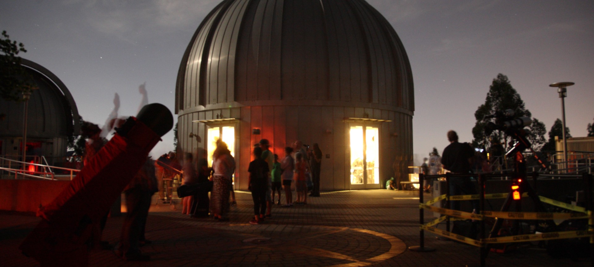
Did you know that Chabot’s large telescopes are sensitive to humidity?
Even sometimes when the sky seems clear, the domes might close because the outside air is too humid. We do this to protect these magnificent instruments.
What visitors need to know for viewing nights:
- If the humidity is greater than 90%, Leah and Rachel will be closed to protect their lenses.
- Nellie is even more sensitive and will be closed when humidity is at or above 85%.
- The Observatories are closed when it is raining.
Check Chabot’s Current Weather Summary to learn what the current humidity is before your visit.
Humidity is subject to rapid changes in our micro-climate, so please check frequently.
Rain and Barometer Information
Chabot’s rain readings are a popular tool for rain gauge fans.
- Heavy rains and winds in the Oakland Hills can cause disruptions in the Weather Stations’ reporting of data.
- If the readouts are not up to date, please try clearing your browser history
Clear Sky Chart
See The Key and More Details on the Clear Sky Chart
What is it?
The Clear Sky Chart below is produced by Attilla Danko, generated from data provided by the Canadian Meteorological Center.
It’s the astronomer’s forecast. At a glance, it shows when it will be cloudy or clear for up to the next two days. It’s a prediction of when Chabot Space and Science Center will have good weather for astronomical observing.
The data comes from a forecast model developed by Allan Rahill of the Canadian Meteorological Centre. CMC’s numerical weather forecasts are unique because they are specifically designed for astronomers. The Clear Sky Chart summarizes CMC’s forecast images just for Chabot Space and Science Center and the surroundings out to about 10 miles.
There are charts for 6375 locations.
How do I read it?
In the rows labeled “sky conditions”, find a column of blue blocks. You can probably observe then.
Read the image from left to right. Each column represents a different hour. The colors of the blocks are the colors from CMC’s forecast maps for that hour. The two numbers at the top of a column is the time. A digit 1 on top of a 3 means 13:00 or 1pm. It’s local time, in 24hr format.
Other Weather Information
Chabot’s Coordinates: 37.81899 N Latitude, 122.18124 W Longitude, 1584 feet elevation.
For even more Chabot weather related data, visit:
Weather Station KCAOAKLA27 – www.wunderground.com


